Cocoa Beach hurricanes: 1979 David, 2004 Frances and Jeanne, and the recurring threat
Every named storm that has hit or threatened Cocoa Beach since 1950, what they did, what was rebuilt, and why the barrier island remains structurally exposed despite a century of building-code changes.
Cocoa Beach has been struck or significantly threatened by at least sixteen named tropical systems since the modern hurricane record-keeping era began in 1950. The geographically most damaging were Hurricane David (1979), Hurricane Frances (2004), Hurricane Jeanne (2004), Hurricane Wilma (2005), Hurricane Matthew (2016), Hurricane Irma (2017), Hurricane Ian (2022), and Hurricane Nicole (2022). Combined damage from these storms to Brevard County structures runs into the hundreds of millions of dollars in 2026-equivalent dollars. The Cocoa Beach Pier has been damaged by virtually every one. Beach renourishment programs (covered in a separate piece) have shipped tens of millions of cubic yards of sand back onto the eroded barrier strip after these storms.
This piece is the chronological record. Each storm is recorded with its track, peak Florida wind speed, Brevard-specific impact, and what was rebuilt afterward.
The 1950–1979 period: thin record, then David
The first 30 years of the modern hurricane record produced no major direct hits on Cocoa Beach. Tropical Storm Cleo (1964) brushed the coast. Hurricane Dora (1964) crossed Florida north of Brevard. Tropical Storm Inez (1966) brought minor coastal effects. None of these warranted FEMA-equivalent disaster declarations for Brevard County, and the Cocoa Beach physical infrastructure (still relatively small in this era) absorbed the impact without major damage.
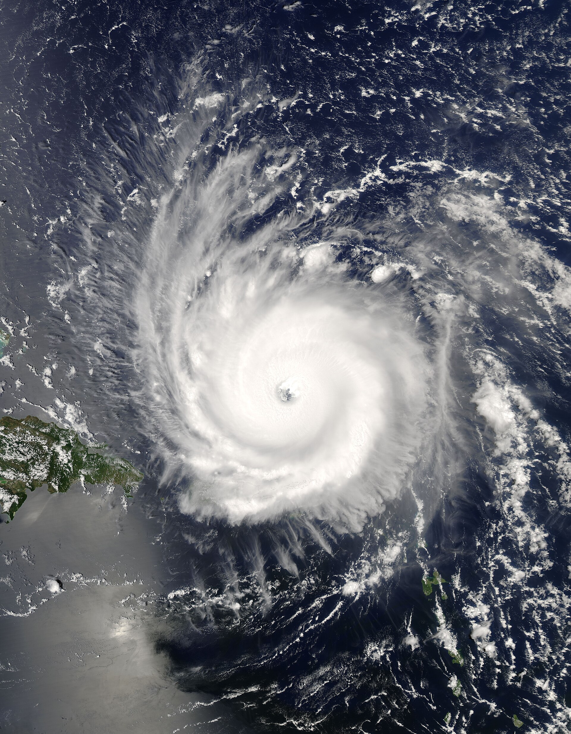
That changed on September 3, 1979, when Hurricane David passed offshore of Brevard County as a Category 2 storm. David had been a major hurricane (Category 5 over the Caribbean), but by the time it tracked along the Florida east coast it had weakened to roughly 90-knot peak winds. Storm surge in Cocoa Beach reached three to five feet above normal high tide. Wave action damaged the Cocoa Beach Pier, eroded the dune line in multiple sections, and flooded ground-floor units of beachfront motels and condominiums.
Damage estimates for Brevard County in 1979 dollars ran to roughly $30 million, of which a meaningful fraction was Cocoa Beach proper. The pier repairs took several months and cost several hundred thousand dollars. Beach renourishment was triggered.
David established the pattern: an offshore-tracking hurricane within 50 to 75 miles of Cocoa Beach delivers tropical-storm-force winds, significant storm surge, and major beach erosion, even if the eye never crosses the barrier strip.
1995 Erin, 1995 Opal, 1999 Floyd
Hurricane Erin (1995) crossed Brevard County as a tropical storm in early August. Minor damage. Hurricane Opal (1995) crossed the Florida Panhandle in October as a major hurricane but produced only tropical-storm-force conditions on the Atlantic coast. Hurricane Floyd (1999) tracked offshore as a Category 4 storm, brought tropical-storm-force conditions to Cocoa Beach, and prompted evacuation orders that affected hundreds of thousands of Brevard County residents.
Floyd is significant in Brevard hurricane history primarily for the evacuation chaos. The 1999 evacuation was, at the time, one of the largest in Florida history. Florida’s east coast emptied northbound on I-95 in such volume that the highway became a fifty-mile parking lot. The state subsequently revised its evacuation contraflow plans in part based on Floyd’s lessons.
2004: Frances and Jeanne, three weeks apart
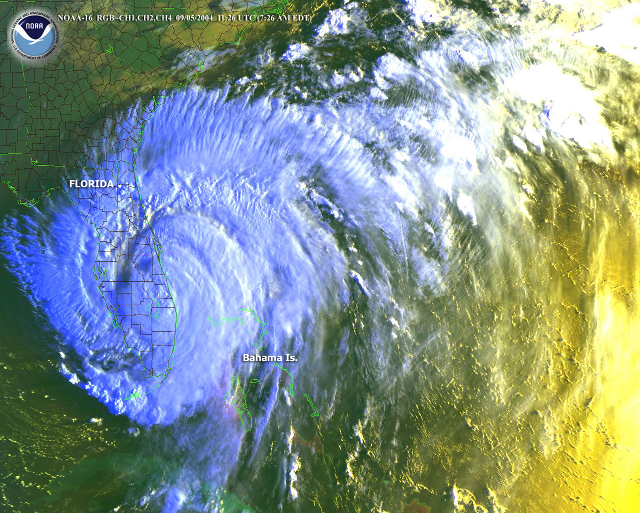
The 2004 Atlantic hurricane season delivered the most damaging hurricane sequence in Brevard County history. Hurricane Frances made landfall on Hutchinson Island (about 100 miles south of Cocoa Beach) on September 5, 2004, as a Category 2 storm, then tracked north-northwest across central Florida. Hurricane Jeanne followed an almost identical track three weeks later, making landfall on Hutchinson Island on September 26, 2004, also as a Category 2 storm, and tracking north-northwest across central Florida.
The combined Frances-Jeanne impact on Cocoa Beach was severe. Both storms produced sustained tropical-storm-force to Category 1-force winds in Brevard. Both produced significant storm surge and beach erosion. The cumulative roof damage to Cocoa Beach residential and commercial structures totaled in the tens of millions of dollars. FEMA’s combined Brevard County disaster declaration for 2004 (covering Charley, Frances, Ivan, and Jeanne) ran to over $400 million in federal assistance to Florida east coast counties.
Cocoa Beach Pier damage from Frances and Jeanne was substantial. Sections of decking were destroyed. Pilings were dislocated. The pier was closed for several months for repairs.
The pace of the two storms, Cocoa Beach hadn’t fully cleared Frances debris when Jeanne arrived, strained the city’s response capacity and the regional building-supply chain. Tarps, plywood, and roofing material became unavailable in Brevard County for weeks. Repair work continued into 2006.
2005 Wilma, 2016 Matthew, 2017 Irma
Hurricane Wilma (October 2005) made landfall near Cape Romano on the Florida Gulf Coast and crossed the peninsula northeast as a weakened Category 2. Brevard County experienced tropical-storm-force conditions and minor beach erosion.
Hurricane Matthew (October 7, 2016) tracked offshore of Brevard County as a Category 3 storm, the closest major-hurricane track to Cocoa Beach in the modern era. The eye passed roughly 25 miles offshore of central Brevard. Wind gusts in Cocoa Beach reached 90 to 100 knots in extreme exposures. Damage was severe: roofs torn off motels along A1A, the Cocoa Beach Pier sustained major structural damage, beach erosion was substantial, and storm surge flooded ground-floor units of beachfront properties. FEMA’s Matthew disaster declaration covered Brevard County.
Hurricane Irma (September 10–11, 2017) approached Florida as one of the most powerful Atlantic hurricanes in recorded history (Category 5 at peak in the Caribbean). Irma weakened before its Florida landfall but still produced major-hurricane impact across the entire peninsula. Brevard County experienced sustained tropical-storm to Category 1 conditions. (See “The 2017 Hurricane Irma evacuation” for the evacuation story specifically.) Damage in Cocoa Beach was significant, particularly to the pier and to less-prepared older structures, but the prior Matthew damage in 2016 had already prompted some hardening that mitigated Irma impact.

2022: Ian and Nicole
Hurricane Ian (September 28–29, 2022) made landfall on Florida’s Gulf Coast at Cayo Costa as a Category 4 hurricane, the deadliest Florida hurricane since 1935. Ian crossed the peninsula and produced significant impacts on the east coast as well. Cocoa Beach experienced tropical-storm conditions, substantial beach erosion, and pier damage that closed the Cocoa Beach Pier for major repairs lasting most of late 2022 and early 2023.
Hurricane Nicole (November 10, 2022) made landfall as a Category 1 storm near Vero Beach, about 70 miles south of Cocoa Beach. Nicole’s impact on Cocoa Beach included additional beach erosion (on top of Ian’s already significant damage), pier impact, and some structural damage to oceanfront properties already weakened by Ian. The Brevard beach erosion from Ian and Nicole combined was, by FDEP estimates, the worst single-season erosion in the modern record.
What the pattern says
Cocoa Beach in 2026 sits on a barrier island that is structurally vulnerable to hurricanes. The geography hasn’t changed. The building stock, while improved by post-Andrew Florida building code (1992) and subsequent revisions, includes many pre-Andrew structures that remain at risk. Hurricane frequency on Florida’s east coast, by NOAA’s modern climate analysis, is trending stable or slightly upward, with rainfall amounts per storm trending higher.
The Cocoa Beach Pier remains the most exposed structure. Every hurricane that comes within 100 miles of the coast tends to damage it. Repair costs trend upward as construction prices rise.
For the broader Brevard County response, beach renourishment, evacuation infrastructure, FEMA history, the pattern is recurring expense. Storm-related federal expenditures in Brevard since 2004 run well into the billions of dollars. The barrier-island development that gave Cocoa Beach its 1960s boom is the same development that produces the recurring storm bill, and that’s not going to change.
For the specific Irma evacuation story, see “The 2017 Hurricane Irma evacuation”. For beach renourishment, see “Beach renourishment, 2000s to now”.
Further Reading
Sources
- NOAA National Hurricane Center, tropical cyclone reports for each named storm, nhc.noaa.gov/data/tcr
- FEMA disaster declarations for Brevard County, fema.gov/disasters
- Florida Department of Environmental Protection, post-storm coastal damage assessments
- Florida Today archives, hurricane coverage 1979 through 2022 (Brevard County Library microfilm)
- Florida Division of Emergency Management, after-action reports
As an Amazon Associate we earn from qualifying purchases.