Gus Edwards buys Cocoa Beach (1923)
How a Cocoa city attorney named Gus C. Edwards picked up the entire Cocoa Beach barrier-island tract at a Brevard County tax sale, platted it, and sold lots, the legal foundation for the 1925 incorporation.
Gus C. Edwards was a Cocoa city attorney, not a developer, not a beach-resort speculator. In 1923 he showed up at a Brevard County tax sale, paid the back taxes on most of the Cocoa Beach barrier-island tract, walked out with title, and within two years had subdivided it into lots, sold them at $25 to $100 apiece, and incorporated a town. That sequence, courthouse purchase, plat, sales, charter, is the legal foundation everything in Cocoa Beach since rests on. The fishing camps, the Holiday Inn the astronauts drank in, Ron Jon, Kelly Slater’s high school, the pier. All sitting on Edwards’s lot lines.
The 1925 incorporation gets the credit in most popular histories. The 1923 tax sale is the one that mattered.
The setup
Brevard County in the early 1920s ran on citrus. The mainland towns of Cocoa, Rockledge, and Eau Gallie had population, businesses, and a railroad. The barrier island across the Banana River, eleven miles of sand, palmetto, and mosquito, had a handful of fishing cabins and almost nothing else. Land on the island had been bought, lost, transferred, repossessed, and frequently abandoned for decades. A lot of it was in tax delinquency because nobody could profitably build on it without a bridge.
There was no causeway. To reach the barrier strip you took a boat across the Banana River from Cocoa, landed somewhere along the lagoon shore, and walked over the dunes to the Atlantic. That’s the geography Edwards was buying into.
What changed his mind, by the surviving accounts, was the Florida land boom. Between roughly 1920 and 1925, Florida real-estate speculation went vertical. Coral Gables was being built. Miami Beach was being built. Investors from the Northeast were arriving by train, buying lots sight unseen, flipping them at multiples within months. A Cocoa city attorney watching that from the Brevard courthouse could do the math: if barrier islands two hundred miles south were the hottest real estate in America, an unbuilt barrier island in Brevard at tax-sale prices might be worth something.

What he actually bought
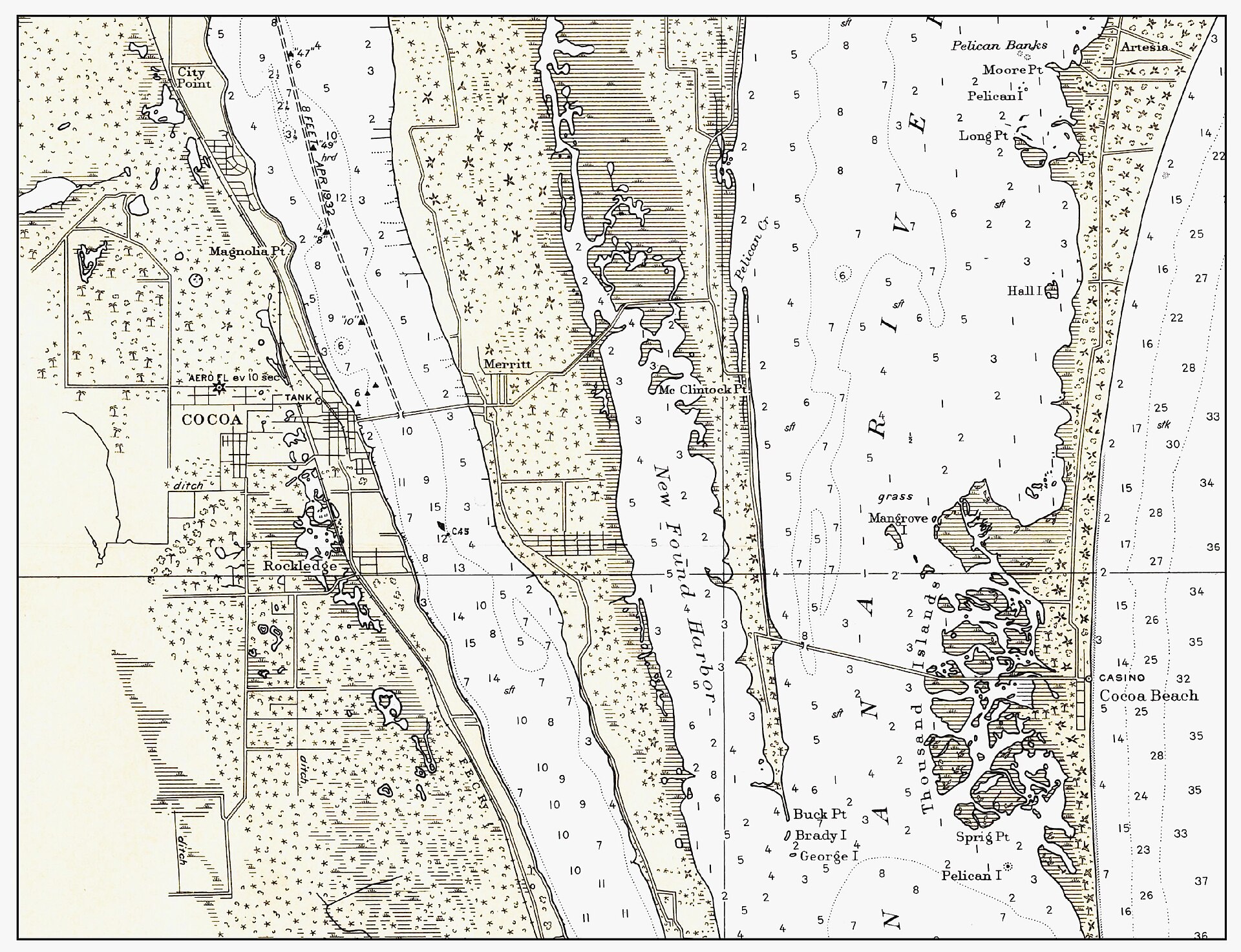
The 1923 purchase wasn’t one transaction. It was a series of tax-sale acquisitions, layered with private deeds Edwards picked up afterward to round out his holdings. Multiple secondary accounts, the City of Cocoa Beach’s official history, Florida Historical Society background materials, describe him acquiring “the entire tract that became Cocoa Beach.” The deed-record reality is more granular: he assembled a controlling interest, then continued to consolidate.
The acreage stretched roughly from what is now Cape Canaveral south through present-day Cocoa Beach, between the Banana River and the Atlantic. Total parcel count in the original plat: several hundred lots laid out on a grid that ran perpendicular to the beach, with numbered streets crossing a north-south spine that would eventually become State Road A1A.
Some of the land Edwards bought had a previous owner whose taxes had lapsed because the owner lived elsewhere, owned the land for speculation, and simply quit paying. Some had previous owners who were Black families that had homesteaded barrier-island parcels in the 1880s and lost them through the tax-sale process common across the Reconstruction-era South. The chain of title is documentable. The full demographic picture of who lost what is a piece of work that still hasn’t been completed.
The plat
Once Edwards held the land, he platted it. The original plat document, filed in Brevard County in 1923 or 1924, depending on which parcel you trace, laid out a town grid: numbered avenues running east-west toward the Atlantic, a north-south spine, and the lots in between. He gave the streets names that would last (some are still on the map a century later) and standardized the lot sizes for resale.
Edwards then sold lots. Prices in surviving advertisements and Florida Memory clippings from the period run $25 to $100 each, payable in installments. Some of the buyers were locals from Cocoa or Rockledge looking for a fish camp or weekend cottage. A few were Northeastern speculators caught up in the Florida boom. A small number were absentee investors who bought lots and never built on them, those parcels would sit empty for decades.
The pricing matters because it tells you what Edwards thought the land was worth in 1923 versus what it would be worth ten years later. At $25 a lot, this was not a luxury subdivision. This was speculation that the boom would arrive in Brevard the way it had arrived in Miami-Dade. The boom did arrive, eventually, but not the way Edwards expected: the catalyst was a military base, then a launch pad, then a moon program, none of which existed when he filed the plat.
The incorporation
By 1925, Edwards had sold enough lots and recruited enough resident buyers to support a charter petition. The town of Cocoa Beach incorporated on June 5, 1925, under Florida law, with a tiny initial population (estimates from the period vary; the 1930 federal census recorded 27 residents in the new town, which gives you a sense of just how empty the place still was). The charter named officers, set boundaries, and put Edwards’s plat on a legal foundation that would outlast everyone who signed it.
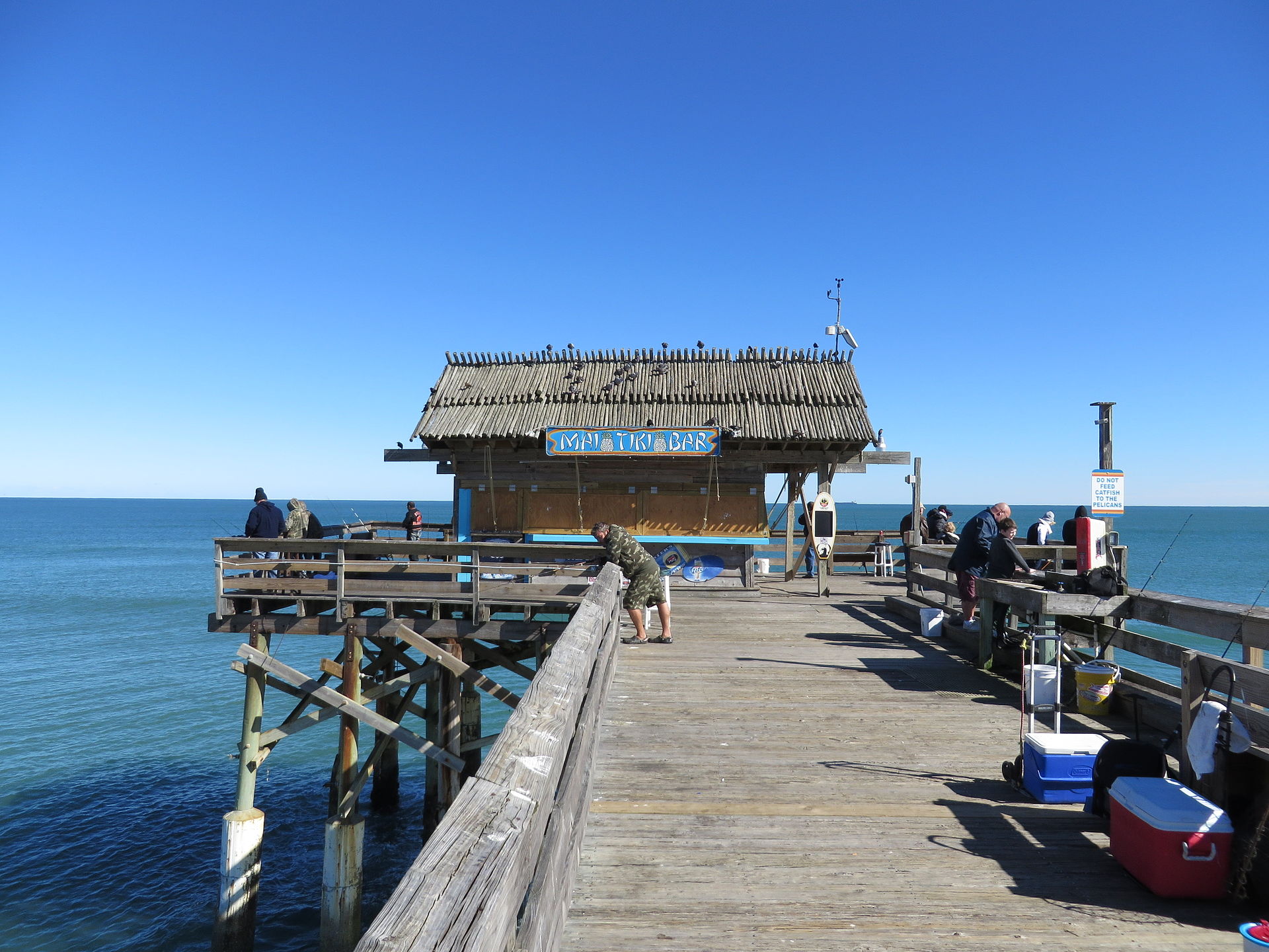
Edwards himself stayed involved in Brevard County politics for years after. The town he platted grew slowly through the Depression, slowly through World War II, and then, beginning in 1950 with the establishment of the Long Range Proving Ground at Cape Canaveral (the future Patrick Air Force Base), began to grow fast. By 1960 the population was 3,475. By 1970 it was 9,952. The Cocoa Beach Edwards platted in 1923 had become the astronaut town.
What Edwards got right and what he didn’t see
Edwards got the land call right. Whatever the deed history under his tax purchases, his bet that barrier-island Brevard would be worth more than $25 a lot was correct by several orders of magnitude. A buildable Cocoa Beach lot in 2026 sells for figures running into the hundreds of thousands; oceanfront acreage trades in the millions.
What he didn’t see, what nobody could have seen in 1923, was that the appreciation wouldn’t come from the Florida land boom or from citrus barons or from northeastern retirees. It would come from rockets. The land’s value was unlocked by a 1950 Department of Defense decision to put a long-range missile-testing range at Cape Canaveral, fifteen miles north of Edwards’s plat. Once that decision was made, the astronauts followed, the contractors followed, the tourists followed, and the lots sold.
The man platted a beach town and accidentally platted the runway to the Moon.
Further Reading
Sources
- City of Cocoa Beach, official history, cityofcocoabeach.com/197/History
- Florida Historical Society, myfloridahistory.org
- Brevard County Clerk of Court, historical deed indices, brevardclerk.us/official-records
- 1925 Florida Special Census; 1930 federal census
- Florida Memory Project, Brevard County collections, floridamemory.com
As an Amazon Associate we earn from qualifying purchases.